The musings, cultural experiences, photos, trials, and tribulations of an American grad student studying medieval history, traveling as much as a grad student budget allows, and drinking lots of tea in the process.
Tuesday, September 7, 2010
The Battle of Culloden
The Battle of Culloden took place in April 1746 on Culloden Moor, a quick 15-minute drive from Inverness. I love this picture, because it's the ONE that the heather actually looks properly purple and not kind of sickish and brown. Anyway, the Battle of Culloden is majorly important in Scottish history. It was here that the Jacobite Uprising collapsed after the British troops decimated the Jacobites. And I do mean decimated- ~2000 dead/wounded and ~375 captured vs. ~350 dead/wounded on the British side. So who were the Jacobites? Let me tell you (briefly, I promise).
Basically, it all broils down to the House of Stuart. Now, keep in mind that English dynastic politics are crazy.
The Stewart/Stuart family started out as the royal line of Scotland and eventually took over the throne of England as well, when the last of the Tudors, Elizabeth I, died without heir. Her cousin, James VI of Scotland and son of Mary, Queen of Scots, succeeded to the throne of England and Ireland following Elizabeth's death. The term "Jacobite" comes from James; James is an English version of the name Jacob. During the reign of Charles I & Charles II, civil war raged across England.
After the Civil War ends, Charles II is restored to the throne. He and his wife never manage to produce an heir, making his younger brother, another James, the heir presumptive. One problem: James is Catholic. And England has been officially and solidly _not_ Catholic since Elizabeth I's reign. Still, he succeeds his brother in 1685, and at first, everything is fine. But James subscribed to a growing belief amongst European monarchies- the idea of absolute monarchy, and his high-handed, dictatorial, and (perhaps worst of all for English Protestants) decidedly pro-Catholic attitudes created a feeling of crisis, brought to a head by James' orders to arrest Protestant clergy, including the Archbishop of Canterbury, England's highest religious office, and the birth of James' son, a viable (and Catholic!) heir to the throne. But all was not lost! James had two daughters by his first wife, a good English Protestant lass. The eldest, Mary, was married to William, Prince of Orange. The English turned to them to defend the English/Protestant way of life. William agrees and arrives in England with an army in 1688, and James was forced to flee to France in exile after much of his own army defects to William's side. Parliament rules James' escape to France as an abdication of the throne and installs Mary and her husband as co-rulers. Thus the "Glorious Revolution" reclaimed the English throne for the Protestants without any bloodshed, and a college in Virginia had monarchs to name itself after.
After William and Mary die without heir (anyone noticing a pattern here?), James II's younger daughter, Anne, takes the throne. She, (you guessed it) also dies without heir, and the throne passes to George I, the descendant of a distant cousin, thus introducing the House of Hanover to the British throne. Meanwhile, back in France, James II's son proclaims himself King James III after II's death, and is recognized by the governments of France, Spain, & the Pope. He tries to retake his throne in 1708 & 1715, but is unsuccessful. He winds up seeking amnesty from the Pope, who grants him a villa and life annuity, and he sets up a court-in-exile at the Papal States, earning himself the nickname "the Pretender." His son, Charles Stuart (aka Bonny Prince Charlie or "the Young Pretender") follows in his father's footsteps with another failed attempt to retake the throne in 1745-6 in another Jacobite uprising. Charles is somewhat more successful than his father, managing to gather some degree of support among the Scottish Highland clans, who viewed the Stuarts as their own rightful kings. He had some early successes, but the Battle of Culloden proved disasterous for his cause and virtually wiped out his support base. Bonny Prince Charlie fled to the Isle of Skye with the help of a Highland lass by name of Flora MacDonald, and from there escaped back to the continent in exile.
The battle took place on Culloden Moor, a flat, marshy, wet area not terribly well-suited for the fighting tactics used by the Highlanders. The "Highland charge," one of the most feared battle tactics of the day proved deadly at Culloden. Soldiers using the tactic would literally charge their opponents while screaming bloody murder and firing muskets until they got within range to do deadly damage in hand-to-hand combat. The English in particular, relying heavily on guns and artillery, found themselves vulnerable to sword and knife-wielding Scotsmen. But the element of surprise was crucial to the Highland charge, and it proved especially effective in the mountains of the Highlands, where a band of screaming clansmen in kilts charging down the mountains could be deadly for the English. Many of the Highlanders were killed in the opening gambits of the battle when they attempted an ill-advised charge with untrained men straight at the royal army. Today, Culloden stands not only as a memorial for the battle, but as a war-grave.
A memorial cairn was erected in 1881 to honor the dead, who were buried in mass graves on the battlefield.
A series of tombstones mark where the various clan units were buried, at least, as near as can be determined.
A series of red (for the Royalists) and blue (for the Jacobites) flags mark the front lines of the respective armies at the battle's commencement, and a brand new Visitors' Centre is located adjacent to the field, with a number of exhibits that are supposed to be worth a look. There's a small fee to get in, but worth checking out. Word to the wise, make sure you've got proper footwear when visiting, especially because it is Scotland and has a tendency to rain rain rain. And the field has a tendency to collect water in giant puddles.
I'm far and away the last person to urge anyone to visit a battlefield; I'm just generally indifferent to them. I think its important to recognize the history of the site, the sacrifices and deaths that occurred there, but really, its a field of grass. Not a whole lot to see & do. I know, I'm from Virginia. I practically live on a Civil War battlefield. But if you happen to be in the area, go check it out. The visitors centre has rave reviews, and the battlefield itself is pretty well marked out so you can sort of get a sense of how the battle played out. And if you've got any Scottish in you, you very well might have relatives buried there. And if nothing else, the moor is quite pretty, although I'd probably have appreciated that fact more if it hadn't been raining and my feet weren't soaking wet!
Saturday, September 4, 2010
Loch Ness & Urquhart Castle
Sadly, this is as close to Nessie as we were able to get. I'm also really proud of this picture because the woman who took it for us got 2 shots: one with Max blinking and the other with Ellen blinking. And you totally can't even tell that I had to edit in Ellen's eyes from the other picture so we all have smiles & open eyes. Of course, now you all know that and will scrutinize the picture, but I'm still proud of myself. So yes, moving on.
Loch Ness!
There it is. A great big lake under misty, rainy, Scottish skies. At this point we are officially near-ish the middle of the Highlands, which I'm going to maintain are absolutely the most gorgeous place on earth until proven otherwise. Just wait until we get further west- Skye and Glencoe are to die for. But then I like mountains.Apparently the best views of Loch Ness can be seen from the tower at Urquhart Castle (below), which overlooks the loch.
I'm sure it is very nice, but they charge you something like 13 pounds to get onto the grounds (eww) and we were here during the one afternoon that it just poured down rain on us. So we skipped the castle and just snapped shots from the castle parking lot, which is actually not a bad place to see the castle from because it is on a cliff overlooking the castle and the loch. Or at least it wouldn't be if there weren't a pretty solid line of trees blocking your view. But there are breaks in the trees, you just have to find 'em.
At this point I should probably toss out there that Urquhart was once one of Scotland's largest castles, and that most Nessie sightings occur near the castle. There are also a number of boats you can ride in the area to get some great views of the loch and the castle (see? There's one right there!). But save it for a day less miserable than the one we had. Urquhart was transformed into the ruin you see today in 1692, when the Royalists destroyed the castle rather than let it fall into the hands of the Jacobites. But for that story, you'll have to wait for the next post highlighting the battle of Culloden.
Labels:
castles,
Epic Roadtrip of Awesomeness,
Highlands,
Lochs,
Scotland
Inverness
The city of Inverness or Inbhir Nis in the Scottish Gaelic straddles the River Ness not far from Scotland's most famous landmark, the Loch Ness. Inverness is one of the largest towns in the highlands and serves as the capital for the region. It has a bit of an industrial feel to it due to the presence of a lot of big farm supply centres on the outskirts of town, and there's not really a whole lot to see and do in Inverness itself. But the centre of town is lovely and has plenty of little shops to peruse, and Inverness is a convenient stopping point with lots of B&Bs in the centre of the Highlands, and there are lots of things to see and do just a short drive away, including Loch Ness, Urquhart Castle, and Culloden Battlefield.
But what Inverness _does_ have is a totally awesome traditional pub by the name of Hootananny.
Hootananny has been listed as one of the best pubs in Scotland for traditional music- and the musicians are there every night, with locals and tourists alike packing the place. We were there on a Tuesday night and it was pretty much standing room only.
Not only were the musicians good, they were set up at the table in the middle of the pub, drinking, playing and talking to the crowd. Most "traditional music bars" treat the music as sort of a gimmick, with the musicians trundled off into a corner, but here, they were very much the centre of the show, with more people showing up to play as the night went on. It was a great time- highly recommended. Also highly recommended- Sammy's Indian cuisine, just down the road from Hootananny. There are also a number of kiltmakers and gift shops in the area, typically with better prices than Edinburgh. I was totally kicking myself because I found the exact same scarf I'd bought in Edinburgh for a fair bit less. If you're really interested in kilts, check out the Highland House of Fraser.
They have a large showroom/gift shop, but they also house the Scottish Kiltmaker Visitor Centre, where for a small fee you can learn all about the history of kilts, how to wear one properly, and how they are made in a little museum.
So that's Inverness. Stay tuned for the aforementioned more exciting things to do in the area.
Labels:
Epic Roadtrip of Awesomeness,
Highlands,
pub,
Scotland,
shopping
Monday, August 23, 2010
The Firth of Forth and Unplanned Detour with Suprising Results #1
Heading north from Edinburgh, you quickly come to the crossing for the Firth of Forth, an estuary of the River Forth. The Firth of Forth is a fjord carved out by glacier activity during an Ice Age, and is kind of fun to say five times fast. Confession: I've renamed Colin Firth in my head. His new name is Colin Firth-of-Forth. Ok, I should stop rambling. Just over the Firth we came across the first of several intriguing signs that prompted us to detour from our planned route. As you can see by the irksome railing, it's difficult to get good pictures of the Firth from the bridge. But just past the bridge, there was a road marked "Coastal Scenic Route." So we figured, what the heck? Let's go see the coast!
Problem: The Coastal Scenic Route, while plenty scenic, does not actually run past the coast, at least not in the half hour we drove down it. But, a hidden surprise totally made it worth while...
The Tuilyies standing stones consist of one large stone almost 8' tall, and a cluster of three smaller ones. Local lore holds that the group are located on the site of an ancient battle and mark the burial sites of chiefs who died in the fighting. The name Tuilyies itself is thought to be a corruption of the word "tulzie," meaning a fight or battle. There's no advance warning- no signs proclaiming "pull over here cuz there's going to be awesome standing stones in 30 seconds!" so we drove past, gasped, and turned around. The stones are located on private property, and barbed wire is up to discourage people from wandering on the grounds, so one has to content themselves with photos taken from a ways away, unless you're prepared to hop barbed wire and trespass where you are clearly unwelcome. Your choice.
And hey look- you can almost see the water! There's also some really adorable little villages along the route, so while the lack of coast was somewhat disappointing, the little detour certainly was not.
Saturday, August 21, 2010
Edinburgh
Behold, Edinburgh, Scotland's capital (and seat of the Scottish Parliament) and second-largest city behind Glasgow. Edinburgh lies in the southeastern part of Scotland along the Firth of Forth, which provides access to the North Sea. Our stay in Edinburgh was brief (dinner & a haunted graveyard tour and then the morning the next day), so we were limited in what we had time to do. The main districts in central Edinburgh are Old Town and New Town, both of which have been designated UNESCO World Heritage Sites by the way. We concentrated on Old Town, which includes Edinburgh Castle, the Royal Mile-- a high street shopping mecca for all things touristy or plaid (speaking of which, didya know using "plaid" to refer to a checked cloth is an American thing? I didn't.)-- St Giles Cathedral, and Holyrood Abbey/Holyroodhouse.
One of the first things you might notice approaching Edinburgh is Arthur's Seat pictured above. The hills here are the remnants of a long-extinct volcano, eroded by glacier activity long ago. The crag upon which Edinburgh Castle is located is another extinct volcano. There are good hiking trails if you want to climb to the peak of Arthur's Seat, or so I've heard, but alas we didn't have time to go check them out. There are a number of ancient hill forts nestled in the crags, including several thought to belong to the Votadini, who are recorded as one of the British tribes north of Hadrian's Wall during the Roman period. Add a few centuries of language change, and they were known as the Gododdin, who ultimately were defeated by the Angles as recorded in a poem from around 600 AD called Y Gododdin.
Speaking of Edinburgh Castle, ta da! Edinburgh Castle is built high on an imposing crag, dominating the city skyline. The site, chosen for obvious defensive features, has been inhabited for almost three thousand years, with the castle dating to at least the 1100s. This was the royal residence for the kings of Scotland until 1603, when the kingdoms of Scotland and England were united under one king, James VI of Scotland, who inherited the throne of England from Elizabeth I, thus becoming James I of England as well.
If you visit, be sure to be there before 1 pm to get a good spot to watch "Shannon the Cannon," a District Gunner with the 105th Regiment Royal Artillery, fire the One O'Clock Gun, a time signal originally used to notify ships in the Firth of Forth of the time. While most people crowd around the gun itself, you can get better views from the level above, outside St Margaret's Chapel. You'll want to scope out a spot about half an hour before hand, or befriend someone who did and get them to take pictures for you. I just went with awkward reaching around the heads of people in front of me.
The shopping thoroughfare leading up to the Castle is known as the Royal Mile. Here you can find all kinds of tartan, scarves, kilts, postcards, pipes, tobacco, etc etc etc. But from my not-so-extensive travels of Scotland, I'll just mention that you can find better deals on the same items outside of Edinburgh- Stirling has plenty of nice shops priced a bit cheaper, and if you're making a stop in Inverness up north, there are a few nice shops there with slightly better prices.You'll also probably find that prices are a bit better off the Royal Mile, which charges a premium as the center of tourist traffic. The one caveat to that statement, is Deacon Brodie's.
Ok, yes, this is just a pub. Not so exciting you say. Well, sure, but it is absolutely adorable from the outside and on the inside, and has really good food for reasonable prices, especially for along the Royal Mile. During the lunch rush, they can take awhile to get your food prepared, but as long as you aren't in a rush, it is a great place to grab lunch or dinner. And conveniently located across the street from St Giles' Cathedral.
St Giles' is a lovely early Gothic building, with some lovely (but relatively young) stained glass. There has been a church on the site since the early Middle Ages, but the cathedral as it stands now was originally built in 1120s; at this point, it was likely relatively small, and would have been Norman (Romanesque if you're continental) in style. At some point it was rebuilt and expanded; this larger early Gothic building suffered damage from a fire in 1385 and was repaired and expanded into the building you see today.
Now, I've bemoaned the fact that most cathedrals do not allow photography inside on several occasions now. But here, I have nothing but praise. St Giles' does not charge admission to visit, but they do ask for a 2 pound donation if you want to take pictures. Totally reasonable, right? I don't know why more churches don't adopt this idea. Fantastic.
To wrap up Edinburgh, I figured I'd finish with a cute story. Here you see Greyfriars Bobby, a little Skye Terrier devoted to his owner. Now, there's several different stories, but the general story line goes that Bobby belonged to a member of the Edinburgh City Police (in some accounts, he was a watchmen for the Greyfriar Kirk, hence Greyfriar and a "bobby" in the UK is slang for a policeman) in the 1850s. Anyway, the dog's owner passed away, and for the next 14 years, Bobby guarded his master's grave until his own death. Sweet, right? Sadly, most of the story is embellished fiction, the creation of an American author who heard the story from a friend who had traveled to Scotland and heard the story there. And like any good game of telephone, much gets lost along the way. In actuality, it is most likely that the dog, who may have even just been a stray, stayed by the grave because a restaurant just outside the graveyard used to toss scraps over the gate into the cemetery. That, coupled with a stone bench thing just next to the grave in question, meant the dog had steady access to food and shelter. Ah well.
There's more photos from Edinburgh Castle, St Giles', and from a haunted cemetery tour we went on through Greyfriar's Graveyard up on flickr if you're interested. Until next time~
Saturday, August 14, 2010
Holy Island & Lindisfarne Priory
Way up off the coast of northern England just shy of the Scottish border is a special place called Holy Island. It is only accessible from the mainland during low tide, when the North Sea recedes enough to expose the Lindisfarne Causeway and allow cars and hikers to pass. The white box on stilts is actually there as a water shelter in the event that anyone gets stuck in the middle of the causeway as the tide comes in. I think this is mostly a concern for hikers in the event that they underestimate how long it will take them to cross the causeway as the tide comes in. And btw, there's no coast guard to come rescue you; you stay put until the tide goes out again.
A little over 150 people make their home on the island in one village, mostly employed in the tourist trade/hospitality. The island is known as a spiritual retreat, but its main tourist draws are Lindisfarne Priory and Lindisfarne Castle.
The castle was built in the 16th century (so quite late) and served largely as a fort in an area long held in contention between the Scots, the English and earlier, the Vikings. The modern castle was largely remodeled in the early 1900s to serve as basically a grand country manor. It is located on the highest point of the island, about a mile away from the village/priory, but a bus service runs every quarter hour between the two if you don't feel like making the hike.
But the real draw, I think, is Lindisfarne Priory. Lindisfarne is one of the oldest Christian establishments in England, founded around 635 by St Aiden, an Irish missionary monk from Iona (a monastery in Scotland also established by Irish missionaries) who established a community on the remote island, which became the center of conversion for northern England. In the 700s, Lindisfarne was a flourishing text-production centre, producing high quality manuscripts, the most famous of which is the Lindisfarne Gospels, now on display in the British Library.
So speaking of Vikings, after 805, the monastery was basically abandoned, since the community had fled with Cuthbert's relics and eventually settled in Durham. After the Norman Conquest, religious life was reintroduced to the island and a priory under the authority of Durham was founded. The ruins you see today date to this period of religious life. The priory also has a fantastic visitors centre display, well worth checking out before you make your way out to the priory itself.
But I think my favorite part when I visited was St Cuthbert's Isle. Now, you have to time it right to actually be able to get to it. St Cuthbert's is located just off the shore of Holy Isle and is only reachable during the very lowest part of low tide, but we lucked out. You have to bounce from rock to rock, trying to avoid the large puddles left by the receding sea, and you'll probably end up crushing a fair few shell-dwellers clinging to the rocks in the process (oops), but so worth it.
Cuthbert's Isle is little more than a big rocky outcrop marked with the above simple wooden cross. It is thought that this is one of the small islands near Lindisfarne that Cuthbert retreated to in order to live as a hermit before he was dragged back to become Bishop of Lindisfarne. And I can honestly say there is something incredibly powerful about the place. On a clear day like we had, there is just rocks and sea and sky blending together with the mainland far off in the distance and the wind whistling across the sea. Perfect for meditation and contemplation.
You can do the major tourist sights in a day or a very busy afternoon, but the next time I go back (and there will be a next time by golly!), I'd try to stay at least one night to really have time to enjoy the quiet and solitude and the natural beauty which drew the early Christians to Lindisfarne in the first place.
Labels:
castles,
Epic Roadtrip of Awesomeness,
monasteries,
Trips
Wednesday, August 11, 2010
Hadrian's Wall Country, Part 1: The Approach from Newcastle upon Tyne
I'm finally (finally!) starting in on what I'm going to call the Epic Roadtrip of Awesomeness, July 2010. Five days, 4 grad students, 1 rental car, 3 tanks of petrol, some # of miles I didn't think to check before we returned the car, 1 big ole road atlas that became my near-constant companion, 3 memory cards full of pictures, and sadly no fried Twinkies or Mars Bars. There was haggis though!
Our first stop on the Epic Roadtrip of Awesomeness was a short hike along Hadrian's Wall Path, an 84-mile long National Trail that runs along- what else?- Hadrian's Wall. If you're interested in a brief overview of the wall, check out my Illuminating Hadrian's Wall entry (you can get to it from the Hadrian's Wall label off to the right sidebar.) We drove up from York and then detoured over from Newcastle towards Hadrian's Wall Country, found a place to pull over, and went for a hike.
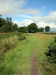
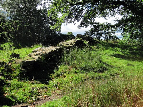
There's not really a whole lot of wall standing in this section of the trail, but you can follow the marked path along where the wall once ran. The less ancient stone fencing running through here is likely built from the stones of the wall. We lucked out and had gorgeous weather; it was supposed to just rain rain rain all week, but aside from a few fairly quick showers, all while we were driving, and a miserably wet and muddy field when we got to Culloden, the whole trip was surprisingly dry.
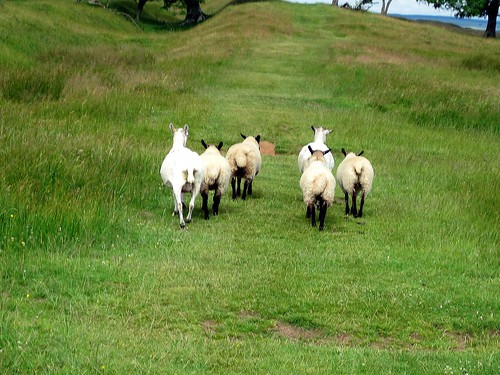
Even though there wasn't a fun wall to climb around on, we still got a welcome chance to stretch our legs and enjoy some scenery. We would have had to drive further out of our way to hit a section of wall still standing, so we decided to just enjoy what we had. The trail is easy to walk and well marked, although you may have to get up close and personal with some sheep.
There's more photos up on flickr if you feel the need for some more idyllic English countryside. But we were particularly excited about this:
Trees! Most of Yorkshire is either moorland or gently rolling hills covered in crop fields. The presence of trees all closely packed together was kind of exciting and necessitated some frolicking :) Anyway, we hiked westward from almost the eastern-most end of the trail; there will be shots featuring actual wall from the western end of the wall coming from Carlisle to wrap up the Epic Roadtrip of Awesomeness series of posts, so I guess look for that in about 10 entries or so! Till next time~!
Labels:
Epic Roadtrip of Awesomeness,
Hadrian's Wall,
Romans,
Trips
Subscribe to:
Posts (Atom)