Showing posts with label Trips. Show all posts

Sunday, October 9, 2011

Hadrian's Wall, Part 3

After our stop in Stirling, we made a quick stop in Edinburgh to pick up some tartan for Ellen and then headed back home. On the return trip to York, we decided to approach from the west so that we could stop off along Hadrian's Wall from the other side and hopefully actually find some wall that still stands. Mission Accomplished!

Hadrian's Wall pt 2 (14) Hadrian's Wall pt 2 (12)

Roman ruins, check. It only took us three trips to Hadrian's Wall Country, but we finally found some of the wall actually still standing. Below is probably one of my all-time favorite pictures. We're a little goofy :)


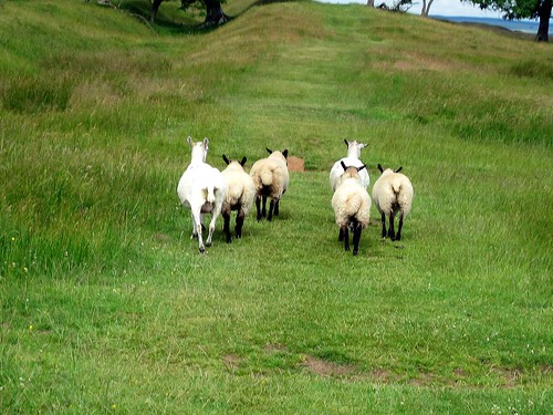
We hiked along the wall for awhile and made friends with some sheep. That's actually a pretty common occurrence for me in the UK/Ireland.

Hadrian's Wall pt 2 (21)
Hadrian's Wall pt 2 (23)


Past the train tracks, we eventually came to  this:

Hadrian's Wall pt 2 (25)

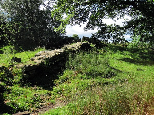
Poltross Burn, Milecastle 48. When the Romans built the wall, they equipped it with "castles" to fortify the wall against the "barbarians" from the North. Of course, since we were there, we took turns invading and defending the wall. I can't remember the final score, but if history is any example, the Celts won eventually. Poltross Burn is one of the best preserved milecastles left. It was built by the the Sixth Legion and was occupied until the fourth century by Roman auxiliary forces- locals recruited into serving with the army in return for Roman citizenship once they retired. While there isn't a whole lot of it left, there's enough to get a general sense of the floor plan, and considering this thing is over 1500 years old, that's pretty remarkable. You can even tell where the staircases once were, since there are still a few steps leading up to nowhere.


Hadrian's Wall pt 2 (8)

After we'd had our fill of Roman masonry, we decided it was dinner time. I don't remember if I mentioned this in the Illuminating Hadrian's Wall post or not, but when we were here for that, we caught the train in Haltwhistle. On our way back to the train station, we passed a Chinese takeaway place that looked pretty tasty. We had an hour or so before our train was going to come, so we could have stopped, but we were overly optimistic and thought we might be able to catch an earlier train home, so instead we rushed down to the station. Of course there was no earlier train, but by the time we found that out, we didn't have time to go back for Chinese food. We decided to remedy that on this visit. We weren't too far from Haltwhistle, and it was getting to be dinner time, so we decided we might as well make for a place we knew had food. And it was far and away the best Chinese I had in England. So if you're in Hadrian's Wall country, I definitely recommend hitting up Haltwhistle and the Chinese place right on the main street.

Hadrian's Wall pt 2 (6)

So that's it for the epic road trip of awesomeness. After dinner, we made our very slow way home via all kinds of twisty narrow roads, but eventually we did make it home. It was a truly unforgettable experience, and huge thanks to Rachel, Max, and Ellen for the excellent company, and Ellen did a great job driving a stick shift on the wrong side of the road!

Monday, September 26, 2011

Stirling

045

It seems kind of strange to be updating my blog about my adventures in the UK when I'm now pretty well settled in at Boston College, but I'm stubborn and I do want to end up with a fairly complete record of my time at York.  So bear with me as I get through the vast backlog of entries.

I know I said at the end of my last post that I'd write about the Ben Nevis distillery next, but... well, it's a distillery. If you've seen one, you've basically seen them all. And odds are, you're really just there to drink, not to actually see anything. So here's two quick pictures and then I'm going to move right along to Stirling.

067066 


Stirling was one of my favorite stops. Well, all of our stops were among my favorite stops, so that doesn't really tell you anything. As medievalists, we loved the history there. Stirling is near the border between the Highlands and the Lowlands and once served as the capital of Scotland and has a fantastic medieval castle. Stirling's Church of the Holy Rude was where the infant James VI, son of Mary Queen of Scots, was crowned king.

Even if you are not a history nerd, Stirling is a pleasure to walk around. They have done a fantastic job making the city, which is admittedly tiny, clean and inviting, with lots of flowers and great shops to poke around in. And prices here are definitely better than in Edinburgh and I think were actually the best we saw in Scotland for touristy stuff. I bought my vaguely Celtic-inspired amethyst earrings here and absolutely love them, so I would save shopping for here and not one of the bigger cities.

155

Oh, and we can't forget William Wallace and Robert the Bruce of course.

Wallace Monument

A couple of significant battles in the Wars of Scottish Independence took place near Stirling- first at Stirling Bridge in 1297 and then at Bannockburn in 1314. William Wallace (Braveheart for us ignorant Americans) was one of the key players at Stirling Bridge and the picture above shows the view of the Wallace Monument just outside of town as seen from Stirling Castle. There's even a giant statue of Mel Gibson at the monument. Apparently visitors would have been confused if it actually looked like William Wallace instead of the movie character. Here's Stirling Bridge today:

174
It is a bit of a hike up to the Castle from the town. This is true of most castles, since you want them up on high cliffs to be defensible, but Stirling's is particularly high up there. This makes for some great views though. Near an odd little cemetery, there is what's called the Ladies' View, which is helpfully marked with this map so that you can identify what you're seeing.

166 

And of course Robert the Bruce still watches out from the castle today.

171

I'm rapidly coming to the close of the Epic Road Trip of Awesomeness. After Stirling we swung back into Edinburgh to pick up some tartan that we could not find ANYWHERE ELSE in Scotland for Ellen, so unfortunately we missed Glasgow, which was supposed to close out our Scottish adventures. I know I was really disappointed that we managed to drive through most of Scotland and didn't get any fried Mars bars, but such is life. From there we swung down to hit the other end of Hadrian's Wall, where we actually got to climb on some wall and pretend to defend it from the invading barbarians. And then we switched sides and attacked those smug Roman invaders. Then a quick stop for Chinese food in Haltwhistle (see Illuminating Hadrian's Wall post) and back to York we went. So I'll be working on getting a Hadrian's Wall post together and then it will be time for Family Style Adventures, featuring my crazy family invading the UK for a week.

Friday, April 1, 2011

Unplanned Detour #2: Neptune's Staircase

I can't recall if I mentioned this earlier, but I played navigator for our Epic Road Trip of Awesomeness. Hence, I had a big ole book of road maps. And as I was look at various routes we could take, I noticed a little "place of interest" icon marking off Neptune's Staircase. I had no idea what it was, but I figured if we ended up going that way, we should check it out. Well, we ended up going that way. And this mysterious "Neptune's Staircase" was only about five minutes out of the way. So we went. And this is what we found near the carpark.

Neptune's Staircase

A short walk from the car put us at the staircase itself. Ta da!

Neptune's Staircase (2)

That right there is one of 8 locks in a big staircase lock on the Caledonian Canal. Also the longest staircase lock in the United Kingdom. Originally hand-powered, but now hydraulic-powered. Aerial photographs of all the locks are kind of neat, but sadly this did not turn out to be some kind of awesome waterfall like I was kind of hoping. Oh well. It was a nice warm day and I got to take a walk. And say I saw Neptune's Staircase.

Neptune's Staircase (3)

Then we got back in the car to hit up a Scottish Whisky distillery. Off to Ben Nevis!

Tuesday, March 29, 2011

Glenfinnan

When I last left off, we were driving through the Highlands towards Fort William along the Road to the Isles. One of the better-known villages along this route is the picturesque Glenfinnan on the shores of Loch Shiel. The town is particularly known for the Glenfinnan Viaduct and the Glenfinnan Monument, as well as its natural setting in the gorgeousness that is the Highlands. I feel like I've spent half of my blog gushing about how much I love and adore the Highlands...

Have I mentioned I love the Highlands? 

Anyway... Glenfinnan! 

glenfinnan (3)

Here we have the Glenfinnan Viaduct. Assuming you don't live under a rock, you are probably already familiar with it. How you ask? Have you seen Harry Potter (the movies, not the books)? If your answer was yes, you have seen the Glenfinnan Viaduct 3 times in Chamber of Secrets, Prisoner of Azkaban, and Goblet of Fire. The Hogwarts Express is showing travelling over the Viaduct. There are plenty of really nice pictures of the Viaduct out there, so I was looking forward to a prime photo op, but alas, they fence it off and you can't get anywhere _near_ the viaduct from the tourist carpark. I don't know why I expected anything else; the UK has a particular knack for putting hedges or trees or fences between you and what you want to see. But I digress.

glenfinnan (5)

If you can recall several posts back when I gave you a longer lecture than usual on the Battle of Culloden, you can find another piece of Jacobite history here in Glenfinnan. Above is the Glenfinnan Monument, built in 1815 to commemorate those who died in the Jacobite rebellion and to mark the spot where Bonnie Prince Charlie first raised his standard in 1745, plunging Scotland into war, ending eight months later at Culloden. So that's Charlie up on top of the tower. 

The area is definitely pretty and a nice spot for a pit stop and a snack bar/concessions area to grab something to eat. The tourist centre carpark is conveniently located next to the Viaduct and the Monument (which, btw, you can pay a pretty penny to go into if you are so inclined). The town proper is a bit further up the road if you want to take a walk. We found this little church to poke around in and then from there walked down to the Loch.

glenfinnan (8)

So go forth! See Scotland! Up next, Unplanned Detour #2 to find out just what the heck "Neptune's Staircase" is.

glenfinnan (6)

Monday, August 23, 2010

The Firth of Forth and Unplanned Detour with Suprising Results #1


Heading north from Edinburgh, you quickly come to the crossing for the Firth of Forth, an estuary of the River Forth. The Firth of Forth is a fjord carved out by glacier activity during an Ice Age, and is kind of fun to say five times fast. Confession: I've renamed Colin Firth in my head. His new name is Colin Firth-of-Forth. Ok, I should stop rambling. Just over the Firth we came across the first of several intriguing signs that prompted us to detour from our planned route. As you can see by the irksome railing, it's difficult to get good pictures of the Firth from the bridge. But just past the bridge, there was a road marked "Coastal Scenic Route." So we figured, what the heck? Let's go see the coast!


Problem: The Coastal Scenic Route, while plenty scenic, does not actually run past the coast, at least not in the half hour we drove down it. But, a hidden surprise totally made it worth while...


The Tuilyies standing stones consist of one large stone almost 8' tall, and a cluster of three smaller ones. Local lore holds that the group are located on the site of an ancient battle and mark the burial sites of chiefs who died in the fighting. The name Tuilyies itself is thought to be a corruption of the word "tulzie," meaning a fight or battle. There's no advance warning- no signs proclaiming "pull over here cuz there's going to be awesome standing stones in 30 seconds!" so we drove past, gasped, and turned around. The stones are located on private property, and barbed wire is up to discourage people from wandering on the grounds, so one has to content themselves with photos taken from a ways away, unless you're prepared to hop barbed wire and trespass where you are clearly unwelcome. Your choice.


And hey look- you can almost see the water! There's also some really adorable little villages along the route, so while the lack of coast was somewhat disappointing, the little detour certainly was not.

Saturday, August 14, 2010

Holy Island & Lindisfarne Priory

032

Way up off the coast of northern England just shy of the Scottish border is a special place called Holy Island. It is only accessible from the mainland during low tide, when the North Sea recedes enough to expose the Lindisfarne Causeway and allow cars and hikers to pass. The white box on stilts is actually there as a water shelter in the event that anyone gets stuck in the middle of the causeway as the tide comes in. I think this is mostly a concern for hikers in the event that they underestimate how long it will take them to cross the causeway as the tide comes in. And btw, there's no coast guard to come rescue you; you stay put until the tide goes out again.

A little over 150 people make their home on the island in one village, mostly employed in the tourist trade/hospitality. The island is known as a spiritual retreat, but its main tourist draws are Lindisfarne Priory and Lindisfarne Castle.

040

The castle was built in the 16th century (so quite late) and served largely as a fort in an area long held in contention between the Scots, the English and earlier, the Vikings. The modern castle was largely remodeled in the early 1900s to serve as basically a grand country manor. It is located on the highest point of the island, about a mile away from the village/priory, but a bus service runs every quarter hour between the two if you don't feel like making the hike.

043

But the real draw, I think, is Lindisfarne Priory. Lindisfarne is one of the oldest Christian establishments in England, founded around 635 by St Aiden, an Irish missionary monk from Iona (a monastery in Scotland also established by Irish missionaries) who established a community on the remote island, which became the center of conversion for northern England. In the 700s, Lindisfarne was a flourishing text-production centre, producing high quality manuscripts, the most famous of which is the Lindisfarne Gospels, now on display in the British Library.

064 St Cuthbert, perhaps the most famous of the medieval English saints, was a monk, abbot and bishop (not at the same time!) of Lindisfarne, but his relics are now resting in Durham Cathedral as a result of the community of monks fleeing the island in the wake of a Viking attack in 875. An earlier Viking attack in 793 was the first major Viking raid in England and caused quite a bit of consternation and fear among contemporaries, even on the Continent. Monasteries were an attractive target for the Vikings because the monks generally couldn't put up much of a fight, and the monasteries were rich with treasures- golden chalices, rich tapestries, various jewel-encrusted treasures, etc. And in the days before banks, wealthy lay people often entrusted their wealth to the religious houses for safekeeping.

So speaking of Vikings, after 805, the monastery was basically abandoned, since the community had fled with Cuthbert's relics and eventually settled in Durham. After the Norman Conquest, religious life was reintroduced to the island and a priory under the authority of Durham was founded. The ruins you see today date to this period of religious life. The priory also has a fantastic visitors centre display, well worth checking out before you make your way out to the priory itself. 

072

But I think my favorite part when I visited was St Cuthbert's Isle. Now, you have to time it right to actually be able to get to it. St Cuthbert's is located just off the shore of Holy Isle and is only reachable during the very lowest part of low tide, but we lucked out. You have to bounce from rock to rock, trying to avoid the large puddles left by the receding sea, and you'll probably end up crushing a fair few shell-dwellers clinging to the rocks in the process (oops), but so worth it. 

090 b+w

Cuthbert's Isle is little more than a big rocky outcrop marked with the above simple wooden cross. It is thought that this is one of the small islands near Lindisfarne that Cuthbert retreated to in order to live as a hermit before he was dragged back to become Bishop of Lindisfarne. And I can honestly say there is something incredibly powerful about the place. On a clear day like we had, there is just rocks and sea and sky blending together with the mainland far off in the distance and the wind whistling across the sea. Perfect for meditation and contemplation.

094

You can do the major tourist sights in a day or a very busy afternoon, but the next time I go back (and there will be a next time by golly!), I'd try to stay at least one night to really have time to enjoy the quiet and solitude and the natural beauty which drew the early Christians to Lindisfarne in the first place.

060


Wednesday, August 11, 2010

Hadrian's Wall Country, Part 1: The Approach from Newcastle upon Tyne

Hadrian's Wall pt 1

I'm finally (finally!) starting in on what I'm going to call the Epic Roadtrip of Awesomeness, July 2010. Five days, 4 grad students, 1 rental car, 3 tanks of petrol, some # of miles I didn't think to check before we returned the car, 1 big ole road atlas that became my near-constant companion, 3 memory cards full of pictures, and sadly no fried Twinkies or Mars Bars. There was haggis though!

Our first stop on the Epic Roadtrip of Awesomeness was a short hike along Hadrian's Wall Path, an 84-mile long National Trail that runs along- what else?- Hadrian's Wall. If you're interested in a brief overview of the wall, check out my Illuminating Hadrian's Wall entry (you can get to it from the Hadrian's Wall label off to the right sidebar.) We drove up from York and then detoured over from Newcastle towards Hadrian's Wall Country, found a place to pull over, and went for a hike.


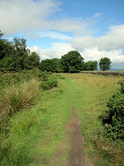
There's not really a whole lot of wall standing in this section of the trail, but you can follow the marked path along where the wall once ran. The less ancient stone fencing running through here is likely built from the stones of the wall. We lucked out and had gorgeous weather; it was supposed to just rain rain rain all week, but aside from a few fairly quick showers, all while we were driving, and a miserably wet and muddy field when we got to Culloden, the whole trip was surprisingly dry.


Even though there wasn't a fun wall to climb around on, we still got a welcome chance to stretch our legs and enjoy some scenery. We would have had to drive further out of our way to hit a section of wall still standing, so we decided to just enjoy what we had. The trail is easy to walk and well marked, although you may have to get up close and personal with some sheep.


There's more photos up on flickr if you feel the need for some more idyllic English countryside. But we were particularly excited about this:

Hadrian's Wall pt 1 (20) picnik'd

Trees! Most of Yorkshire is either moorland or gently rolling hills covered in crop fields. The presence of trees all closely packed together was kind of exciting and necessitated some frolicking :) Anyway, we hiked westward from almost the eastern-most end of the trail; there will be shots featuring actual wall from the western end of the wall coming from Carlisle to wrap up the Epic Roadtrip of Awesomeness series of posts, so I guess look for that in about 10 entries or so! Till next time~!

Monday, August 9, 2010

Selby Abbey


Behold, Selby Abbey. One of very few surviving monastic churches (most got torn down following the Dissolution of the Monasteries in the late 1560s as part of Henry VIII's creation of the Church of England). You may recall from an earlier entry that Westminster Abbey also survived the transition, but unlike Westminster, which was turned into a cathedral by royal decree, Selby managed to survive because it had already become the parish church for the local community and so continued to fill that role just minus the monks.


Selby was founded in 1069 and clearly reflects its Norman heritage; the chevrons over the main entrance are classic Norman architectural features, as are the engraved columns, which are similar to ones found at Durham Cathedral. Selby also has a few little oddities that set it apart. The picture just above is looking through the Leper's View- this is actually a 17-foot passage through the walls of the church which allows someone standing on the outside to look in to the sanctuary. Legend goes this was so lepers & other undesirables you wouldn't want parading around your church could still participate in worship. This is unusual, because most of the time these leper portals actually just allowed someone in a side chapel to peak at the main altar, but this one legit goes outside. Whether it was ever used by any lepers is unknown.


This is actually looking inside the carved capitol of a column adorning an outer wall of the church. I forget who this was supposed to be, but it is one of the more bizarre things I've seen in a church. You have to use the provided torch (US: flashlight) to even see he's there at all.

This came as a surprise to us Americans. Who knew there was an American Heritage Trail in the UK? Apparently not very many people since I can't even mind any mentions of it online. Selby is included because the family coat of arms of George Washingon's ancestors is included in a stained glass window. The window dates to the 14th century and is thought to be the earliest representation of the Washington coat of arms. So why do we care? Well, there's some thought that the crest, which features three red stars above alternating red & white stripes, was the inspiration for our own Stars and Stripes on the American flag. No one's quite sure why the crest is here; presumably some long-distant relative of George gave the monastery a sizable donation to be thus commemorated, but like many things, the details are lost to time.


Thursday, August 5, 2010

Sandal Castle

In case you haven't noticed a running theme on the blog, I like ruins. Monastic ruins are nice, but they all follow the same layout, so usually the only real difference from one abbey to another is the extent to which the buildings are still standing. Castles on the other hand, well, castles are fun precisely because they vary so widely. So here's another castle for you.

Sadly, there is very (and I do mean very) little left of Sandal Castle. Like Pontefract, it was a royalist stronghold during the English civil war, but after a few centuries in the possession of the monarchy, who basically ignored it and let it get run down, it was already in bad shape before the war, and was deliberately destroyed by the Parliamentarians after the war. Originally built in timber around 1100 by the Warrenes, the earls of Surrey, Sandal was eventually rebuilt in stone around the 1300s. Like Pontefract, it is a motte and bailey construction; this is typical especially in the North, where a lot of castles were erected very quickly following the Norman Conquest. The northerners tended to resist anyone telling them what to do, so castle building was a key Norman strategy for gaining control over the troublesome North. Making a big pile of dirt and rock and then slapping a wooden tower on it is quick and requires very little in the way of skilled labor, so motte & baileys could be built quickly and easily with minimal expense. It was when these castles proved worth keeping up for a long period of time that they tended to be rebuilt in stone like at Sandal.


Here you can see where the motte would've been on the artificial hilltop, while the smaller mound off to the left of the photo would be the bailey area.


As you can see, the Parliament did a pretty thorough job dismantling the castle, which once would have been a hugely massive and impressive structure. In the 1400s, there was no Warenne heir, so the castle passed to King Edward III and from the king, to one of his younger sons. One of the king's other sons held Pontefract, and the two of them held several castles throughout the North and the borderlands with Scotland. This son became the first Duke of York, which embroiled Sandal in the War of the Roses during the second half of the 1400s, as the Houses of Lancaster (the red rose) and York (the white rose) competed for the throne of England. The monarchy swung from house to house as various kings were defeated in battle. Both Lancaster and York were the descendents of Edward III's younger sons (as the branches from the older sons had died out). The wars finally ended with Henry Tudor (Henry VII), the Lancastrian candidate after a whole slew of closer relatives died in the wars, beating out Richard III (of York) and marrying Elizabeth of York to bring the two houses together.

Before Richard III had come to the throne, his father, also Richard, attempted to gain the throne. He led his troops from Sandal against those of Queen Margaret based out of Pontefract. They met at the Battle of Wakefield, where Margaret's troops won a crushing victory and Richard was killed. But then his son became king, so I guess it all worked out in the end. Margaret herself is an interesting lady. Her husband, Henry VI was, well, insane, so Margaret was effectively ruling England and parts of France herself. She also sort of started the Wars of the Roses by snubbing the Yorkists and then proceeded to lead the Lancastrians for many years. Anyhoo, the Battle of Wakefield is where the mnemonic British kids use to learn the colours of the rainbow comes from: Richard Of York Gave Battle In Vain. Much more effective than Roy G. Biv, I think. Shakespeare also used Sandal as a setting in Henry VI Part 3 as it discusses Richard (the one who lost at Wakefield) learning of Margaret's approach and then his subsequent death.

Bonus for castles? They're fun to climb on :)

And being built on a hill means awesome views of the surrounding area.